OHIO SHALE
The Ohio Shale is a ~600’ to
>2000’ thick, Upper Devonian unit of mostly dark shales. It is
extensively exposed in an outcrop belt extending from northeastern Ohio to
central Ohio to southern Ohio, and into Kentucky. Correlative units are present
elsewhere in the Appalachian Basin (Chattanooga Shale), the Illinois Basin (New
Albany Shale), and the Michigan Basin (Antrim Shale).
In northeastern Ohio, the
Ohio Shale is subdivided into three readily recognizable units: a basal Huron
Shale Member (black shales), a middle Chagrin Shale Member (soft
gray shales), and an upper Cleveland Shale Member (black shales).
Cleveland Shale Member
--------------------------------
Chagrin Shale Member
--------------------------------
Huron Shale Member
Published biostratigraphic
information has indicated that the Frasnian-Famennian boundary (= lower Upper
Devonian-upper Upper Devonian boundary) occurs somewhere in the Huron Shale
Member. Age-diagnostic conodonts found in the Chagrin Shale and the
Cleveland Shale indicate a late Famennian age for both of those units (see
Zagger, 1989, 1993, 1995).
In northeastern Ohio, a thin
pyrite bed occurs immediately above the Chagrin Shale-Cleveland Shale
disconformity. It is called the Skinners Run Pyrite Bed.
The Ohio Shale is sparsely
fossiliferous in general, but a relatively diverse biota has been recorded that
consists of invertebrates, vertebrates, plants, and microfossils. The
most famous Ohio Shale fossils are arthrodire placoderms and sharks from the
Cleveland Shale.
References
Zagger, G.W. 1989.
Age and origin of the Skinners Run Pyrite bed, Cuyahoga County, Ohio. Ohio
Journal of Science 89(2): 9.
Zagger, G.W.
1993. Preliminary conodont biostratigraphy of the uppermost Famennian
Ohio Shale in northeast Ohio. Geological Society of America Abstracts
with Programs 25(3): 92.
Zagger, G.W.
1995. Conodont Biostratigraphy and Sedimentology of the Latest
Devonian of Northeast Ohio. M.S. Thesis. Case Western Reserve
University. Cleveland, Ohio, USA. 112 pp.
CLEVELAND SHALE
The Cleveland Shale Member
is the uppermost unit of the Ohio Shale. It is typically a
blocky-weathering black shale unit. In northeastern Ohio, the lower
Cleveland Shale consists of interbedded gray shales and black shales with
relatively common siltstone beds. The lower Cleveland Shale in
northeastern Ohio is distinctive enough that a separate stratigraphic name has
been proposed for it, the Olmsted “Member”. This name is not recognized
by the Ohio Geological Survey.
The Cleveland Shale
disconformably overlies soft gray shales of the Chagrin Shale, and is
conformably overlain by gray shales, siltstones, and minor fine-grained
sandstones of the Bedford Shale.
The Cleveland Shale is late
Famennian in age (near-latest Late Devonian).
EUCLID CREEK Section
The most easily accessed
locality in the Cleveland area for seeing the base of the Cleveland Shale is a
small creek cut along the western side of Euclid Creek Parkway, very near
Euclid Creek (northern part of the town of South Euclid, northeastern Cuyahoga
County, northeastern Ohio, USA). (GPS: 41° 32.611’ North, 81°
31.647’ West)
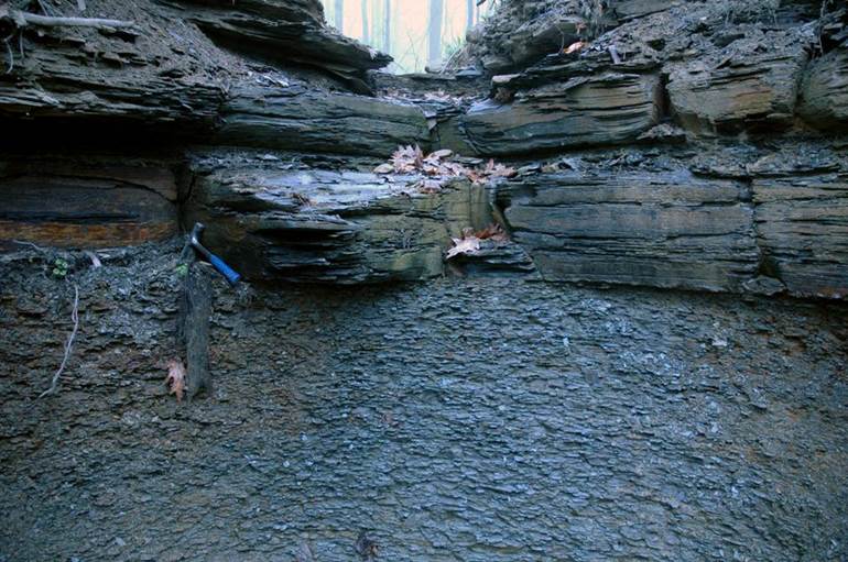
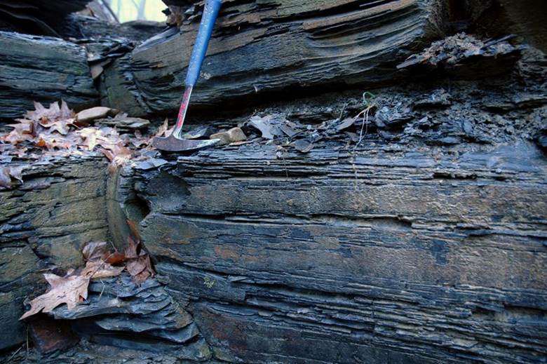
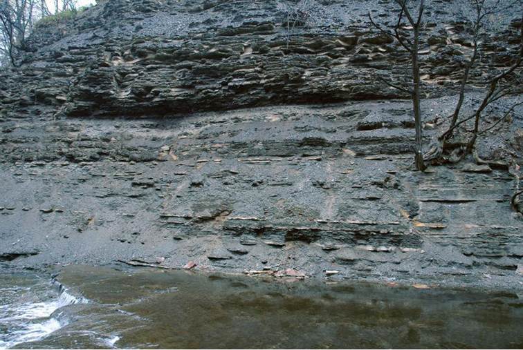
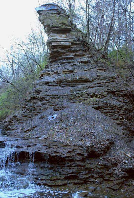
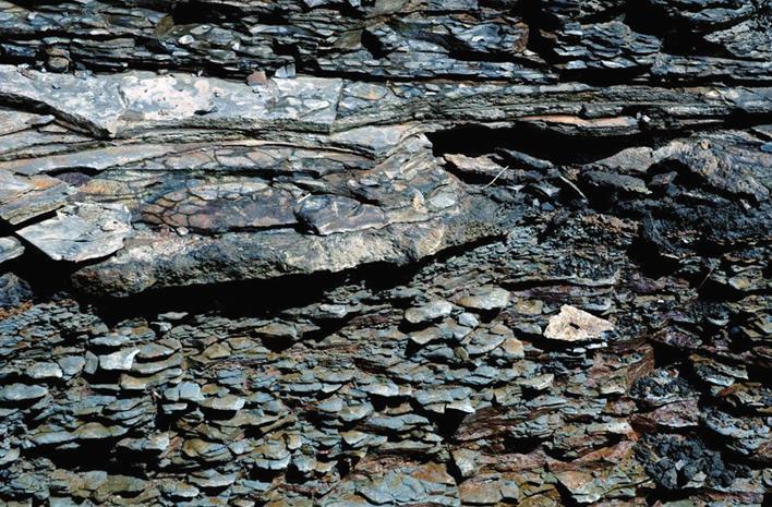
This pic shows the Chagrin
Shale-Cleveland Shale contact. The soft gray shales in the lower half of
the photo is the uppermost Chagrin Shale. The black, blocky-weathering
shales above are the basal Cleveland Shale. The contact (disconformity)
is sharp and planar at this locality.
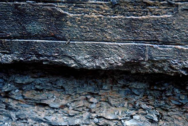
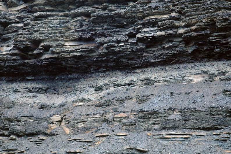
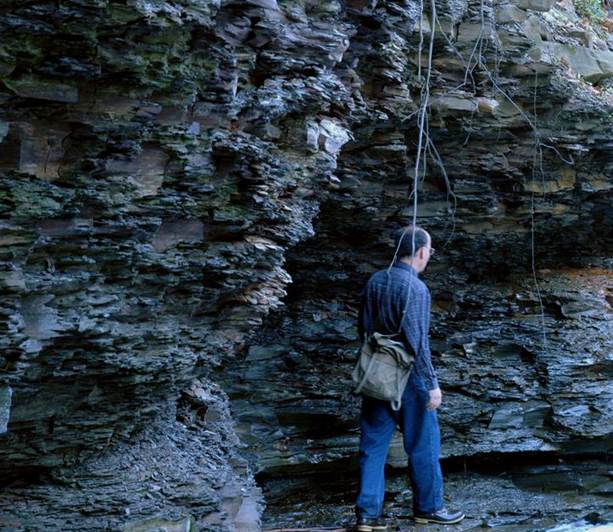
The closeup of the
Chagrin-Cleveland disconformity here shows a thin, “rough”-looking layer at the
base of the Cleveland. This is a pyrite-rich basal lag called the
Skinners Run Pyrite Bed.
The basal Cleveland Shale
here consists of finely laminated black mudshales. Fossil fish have been
found at this locality.
On the eastern side of
Euclid Creek Parkway is Euclid Creek itself, which has a complete, well-exposed
section of the Cleveland Shale.
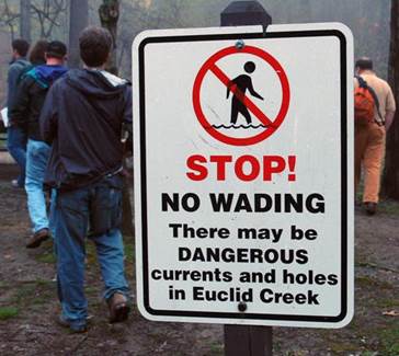
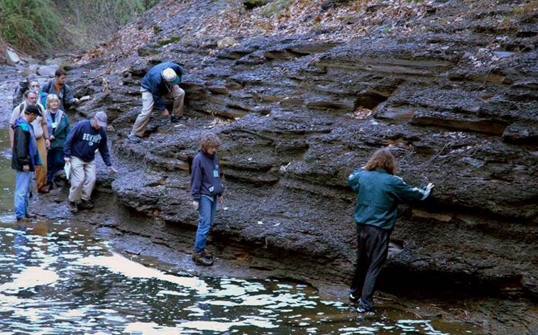
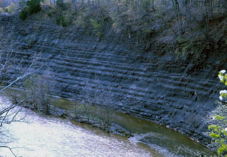
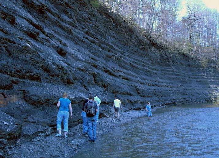
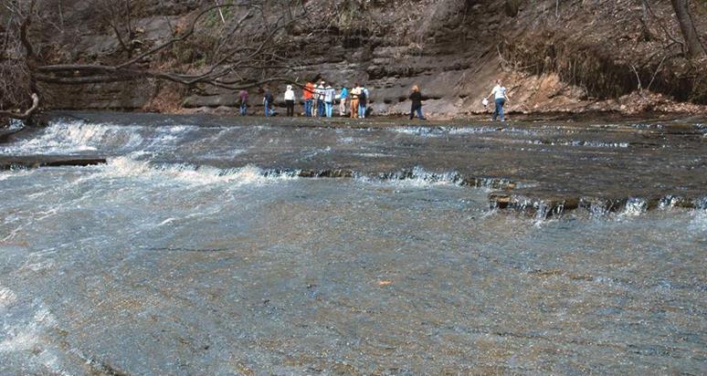
Here we see a group of
geologists heading toward Euclid Creek, about to spend a couple of hours wading
in Euclid Creek to examine a section of the Cleveland Shale. (The
Cleveland Museum of Natural History has permission to bring groups of
geologists into Euclid Creek.)
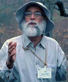
Joe Hannibal, a
paleontologist at the Cleveland Museum of Natural History, is an expert on the
stratigraphy and paleontology of northeastern Ohio’s Cleveland Shale
unit. He has led several geology field trips into Euclid Creek.
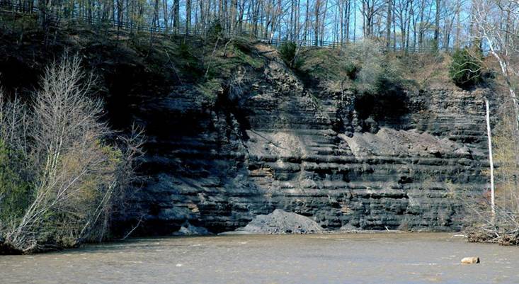
Here’s the Chagrin
Shale-Cleveland Shale disconformity exposed in a creek-side cliff along Euclid
Creek. The Chagrin is the soft gray shales below. The Cleveland is
the blocky-weathering black shales above.
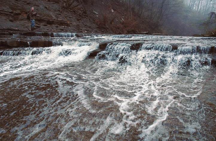
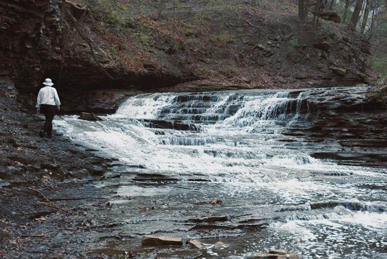
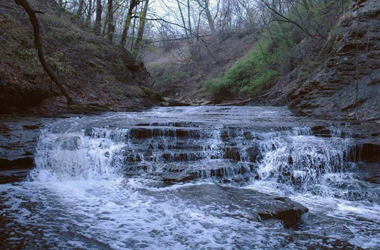
A nice waterfall occurs
where the Chagrin-Cleveland contact crosses Euclid Creek. Many of the
waterfalls in Euclid Creek are at stratigraphic boundaries.
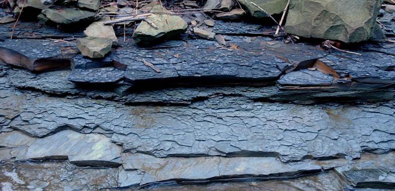
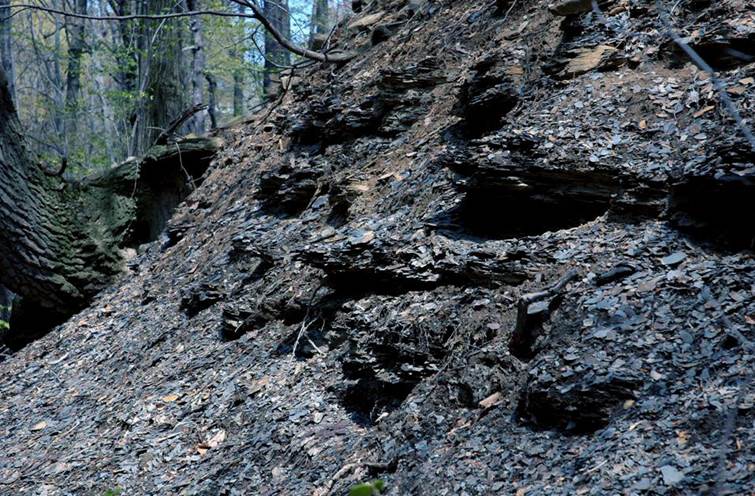
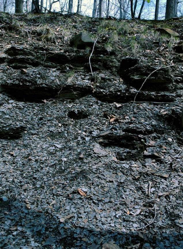
The Cleveland Shale along
Euclid Creek (& at other localities in the Cleveland area) has two
lithologically distinctive units: a lower interval of interbedded gray shale
& black shale with relatively common siltstone beds; and an upper interval
of almost entirely black shale. The lower unit is locally called the “Olmsted
Member”.
The lower half of the pics
above & below shows the Olmsted Member (= lower Cleveland Shale), with the
“true” Cleveland Shale above. The Olmsted-Cleveland contact is a sharp
& planar, occuring at the base of the blocky-weathering black shales.
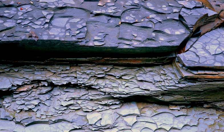
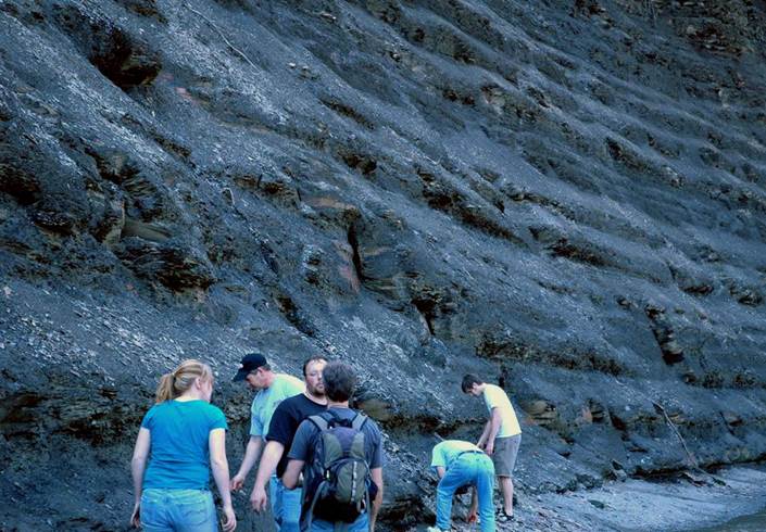
The photos below show well
the interbedded black shale-gray shale nature of the Olmsted “Member” of the
lower Cleveland Shale.
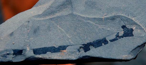
The Cleveland Shale is
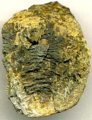
sparsely fossiliferous, but fossil remains can be found. Below is a
flattened, carbonized plant on weathered black shale talus found on a gravel
bar in Euclid Creek. Some fossil plant stems (“trunks”) found in the Ohio
Shale are 5 feet long.
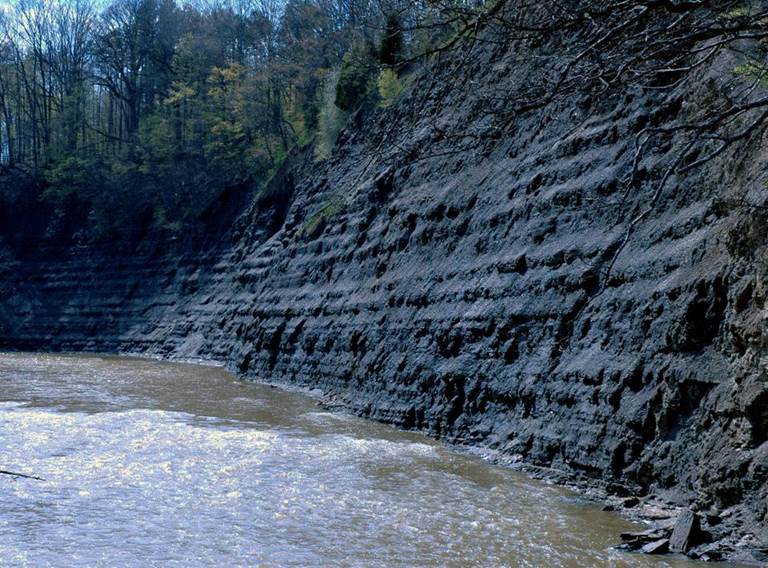
The upper Cleveland Shale is a blocky-weathering black shale succession that often forms cliffs along creeks (true in northeastern Ohio & central Ohio).
The photos below show a
Euclid Creek waterfalls going over the near-uppermost Cleveland Shale.
Above & below: black
shales of the upper Cleveland Shale along Euclid Creek. The exposure
below shows a “ribby-weathering” pattern to the Cleveland Shale.
This rhythmic deposition was probably influenced by long-term
paleoclimatic cyclicity (Milankovitch cyclicity?).
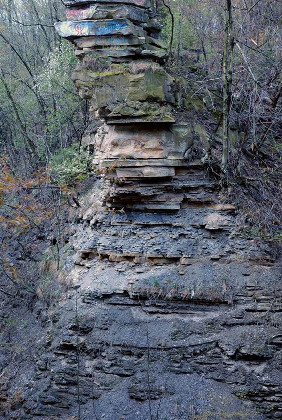
The Cleveland Shale is conformable
with the overlying Bedford Shale. The Cleveland-Bedford contact is about
one-third of the way from the bottom of the photo below, about where the first
prominent brownish siltstone bed occurs. This pillar occurs a little
north of the Monticello Blvd. bridge over Euclid Creek.
The thicker quartzose
siltstone beds at the top of this weathered pillar represent the Euclid
Siltstone, variously called a member of the Bedford Shale or a facies of the
Bedford Shale.
The Bedford Shale & the
Euclid Siltstone are late Famennian in age (near-latest Late Devonian).
DOAN BROOK Section
The Doan Brook section is
located on the western side of Cleveland Heights, northeastern Cuyahoga County,
northeastern Ohio, USA. The section consists
of creek-bank exposures that expose the upper Chagrin Shale, the entire
Cleveland Shale, the Bedford Shale, and the Euclid Siltstone (all upper
Famennian Stage, near-uppermost Upper Devonian).
John Strong Newberry first
named the Cleveland Shale in the late 1800s based on the Doan Brook
section. The section is not spectacular, but it is still available for
examination & collection. Like other sections, the Cleveland Shale at
Doan Brook consists of finely horizontally laminated black mudshales. The
fissility of these shales results in very thin shale chips upon weathering.
ROCKY RIVER Section
A nice section of Cleveland
Shale is found along Rocky River, which flows north toward Lake Erie. The
has formed a decently incised valley. The Cleveland Shale is well exposed
in rivercuts near the confluence of Rocky River and its West Branch at Cedar
Point, northern side of Cedar Point Road, a little west of Cleveland-Hopkins
Airport, western Cuyahoga County, northeastern Ohio, USA; GPS of site:
41° 24.429’ North, 81° 53.259’ West. This cut is part of Cleveland’s city
park system - Rocky River Reservation.
The Cleveland Shale Member
(upper Ohio Shale) here consists of dark, “ribby”-weathering, fissile
shales. Both the “Olmsted Member” and the “true” Cleveland Shale are
exposed here.
Looking ~W. River is flowing toward viewer.
Looking ~SW. River is flowing to the lower right.
Looking ~NNE. River is flowing away from viewer & to the
right.
Looking ~N. River is flowing away from viewer.
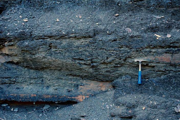
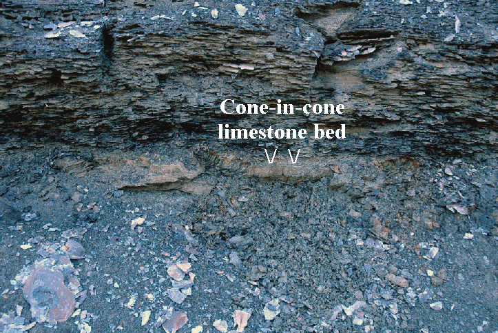
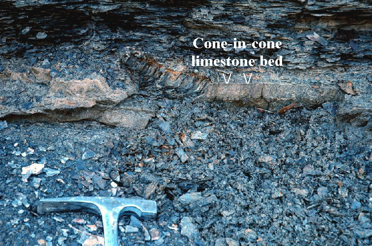
In addition to dark fissile
mudshales, the Rocky River section also has some cone-in-cone limestone
beds. The hard bed shown in the pics above & below is a cone-in-cone
limestone horizon. Cone-in-cone beds are thought by some to be pressure
solution features, but no geologist knows for sure how they form. These
also occur in the Ohio Shale of central Ohio. In places, they can be seen
to bifurcate or trifurcate laterally, and they are not always congruent with
the shale bedding above & below.
The three photos below show
the front & back of a hand sample from the cone-in-cone limestone bed shown
above. The first 2 photos below show the cone-in-cone geometry (see “V”s
in 2nd pic).

Sample is 20 mm tall & 26 mm across.
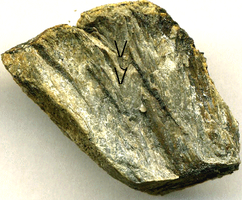
The above is the flip side
of the same cone-in-cone limestone sample. Each transverse line
represents a cone structure nested inside another cone structure.
The Rocky River section of
the Cleveland Shale is world-famous, principally because a large arthrodire
skull (Dunkleosteus terrelli) was excavated here in 1928 by Peter
Bungart (see photo
of original excavation). (See stylized model of arthrodire below.)
Only one fish fossil was
found at Rocky River during my short visit on 22 April 2006 - a fossil fish
scale on a chip of dark shale (see pic below).
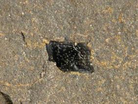
Fish scale measures ~3 mm diagonally.
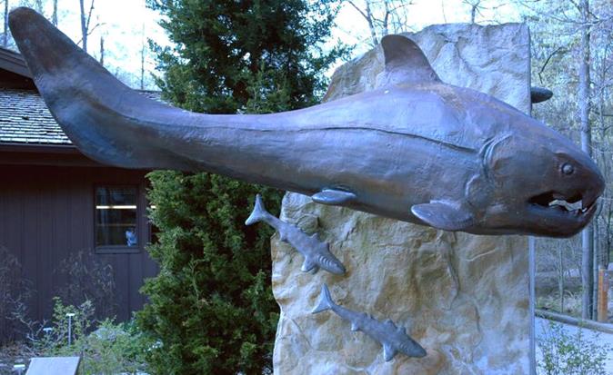
Stylized reconstruction of
an arthrodire placoderm (inspired by Dunkleosteus terrelli). The
lower fins of arthrodires are now known to have been much longer than is
depicted here.
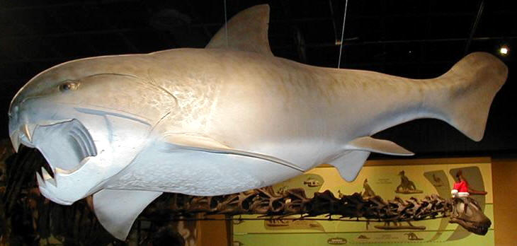
Dunkleosteus terrelli model on display at the
Cleveland Museum of Natural History (CMNH) in Cleveland, Ohio, USA.
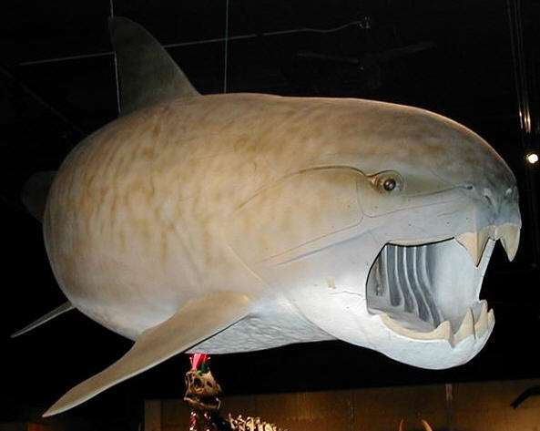
Dunkleosteus terrelli model on display at the
Cleveland Museum of Natural History (CMNH) in Cleveland, Ohio, USA.
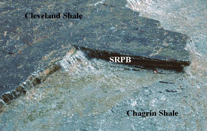
SKINNERS RUN
PYRITE BED
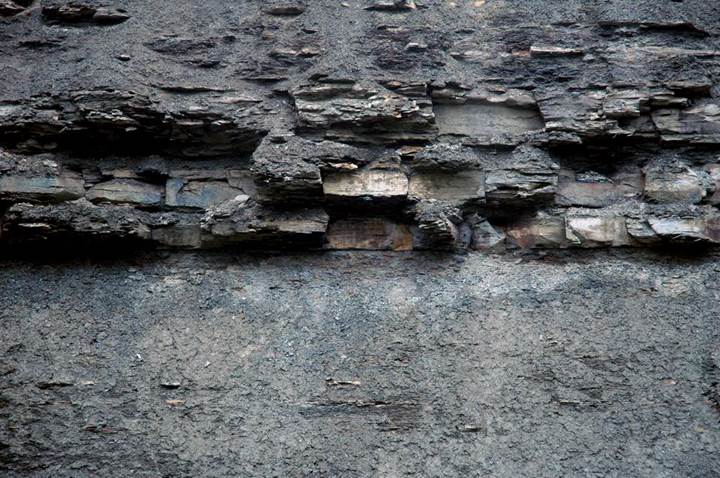
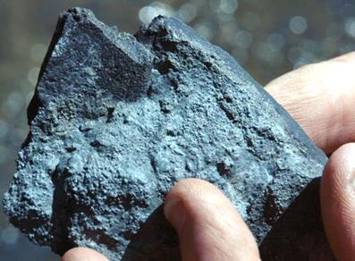
The Skinners Run Pyrite Bed is a pyrite-rich basal lag at the base of the Cleveland Shale Member of the Ohio Shale, immediately above the Chagrin Shale-Cleveland Shale disconformity. It is distributed throughout Cuyahoga County in northeastern Ohio, USA. The type section is a series of stream cuts along Skinners Run (a.k.a. West Creek; a.k.a. Little Run) at Brooklyn Heights Village Park, central Cuyahoga County, northeastern Ohio, USA.
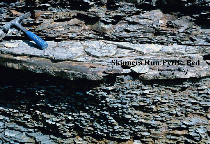
The photos above & below
show the Chagrin Shale-Cleveland Shale contact (disconformity). The
uppermost Chagrin is the gray shale below. The black shale-gray shale
beds above are the basal Cleveland (“Olmsted Member”). Right at the
boundary is the Skinners Run Pyrite Bed (SRPB), which varies in thickness here.
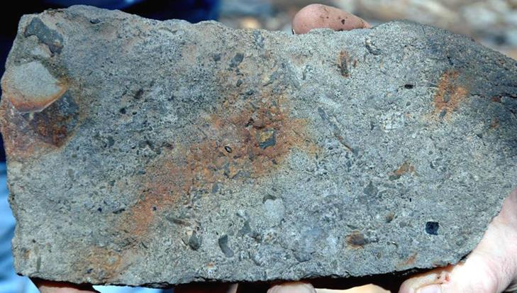
Here’s a hand sample of the Skinners Run Pyrite Bed. The elongated black spot near the center is a shark tooth. The rounded-squarish black structure at the lower right is a bone fragment. The bed consists of abundant pyrite spheres, pyrite framboids, redeposited pyrite-filled burrows, and other pyritized biogenic debris. Blackish-colored fish bones are moderately common in this bed.
The large black structure in this photo is a decent-sized bone fragment from an arthrodire placoderm, in Skinners Run Pyrite Bed matrix. The pores of this fossil bone are filled with brassy-colored pyrite.
The Cleveland Shale is world
famous for its fossil arthrodire placoderms (Animalia, Chordata, Vertebrata,
Placodermi, Arthrodira). The most famous arthrodire found in the
Cleveland Shale is Dunkleosteus terrelli.
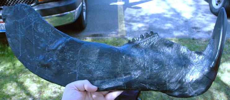
Replica of an infragnathal
(lower jaw bone) from an arthrodire placoderm (Cleveland Shale, northeastern
Ohio, USA). Replica produced by the Cleveland Museum of Natural History
(CMNH).
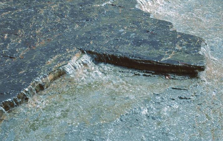
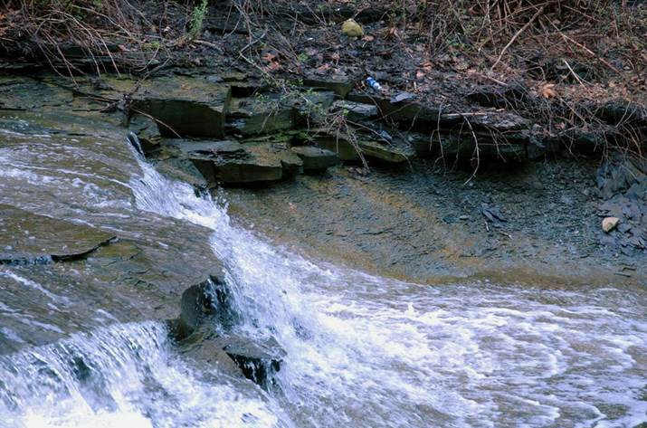
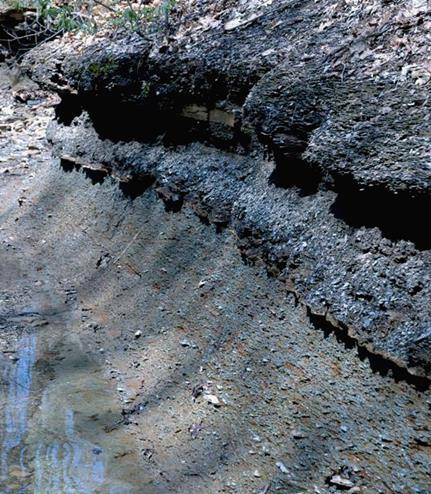
Where the Skinners Run
Pyrite Bed (Chagrin-Cleveland contact) crosses the creek, it forms a small
waterfalls. The gray shale of the Chagrin is easily seen through the
water in the lower part of the photos. Dark-colored shales of the
Cleveland Shale occur above the SRPB at creek level, and continue up the
creek-side cliff in the background.