RICHMOND GROUP
The upper part of the Cincinnatian
Series in southwestern Ohio, southeastern Indiana, and northern Kentucky is
called the Richmond Group (Richmondian Stage, upper Upper Ordovician). In
general, the Richmond Group consists of the following formations:
DRAKES FORMATION
(youngest)
WHITEWATER FORMATION
LIBERTY FORMATIO
WAYNESVILLE FORMATION
ARNHEIM
FORMATION (oldest)
The upper Richmond has also
been referred to as the Elkhorn Formation.
In southeastern Indiana, the
upper & lower Whitewater are separated by a distinctive unit called the
Saluda.
CAESAR CREEK LAKE'S EMERGENCY SPILLWAY
MIAMISBURG RAILROAD CUT
OHIO BRUSH CREEK AREA
CAESAR CREEK
LAKE'S
EMERGENCY SPILLWAY
The most intensely collected
fossil locality in North America is arguably Caesar Creek Lake's emergency
spillway. It is located on either side of Clarksville Road, just south of
the Caesar Creek Lake Dam in northeastern Warren County, southwestern Ohio,
USA.
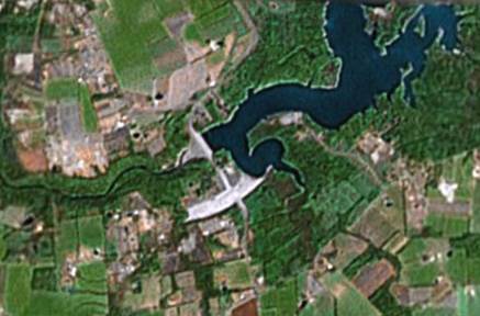
Caesar Creek Lake's emergency
spillway is the whitish curved area on the south side of the lake. (Satellite photo provided by
TerraMetrics & DigitalGlobe & Google Earth)
The Caesar Creek spillway is
overcollected, but nice & rare & new fossils can be found.
Looking ~E.
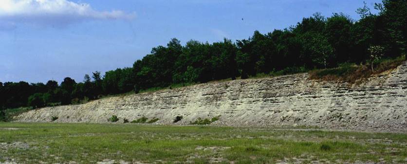
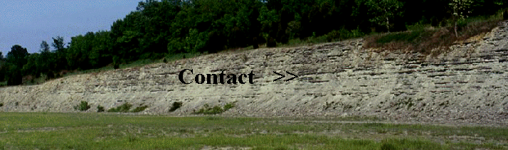
The pics above & below
show the Caesar Creek spillway on the northeastern side of Clarksville
Road. Fossils occur on the spillway flats & along the cut wall.
The cut wall & the spillway floor seen above have fossiliferous limestones
& shales of the upper Liberty Formation and lower Whitewater
Formation. The approximate position of the Liberty-Whitewater contact is
shown below.
MIAMISBURG RAILROAD CUT
A nice exposure of
Waynesville Formation occurs along a railroad adjacent to the Department of
Energy's Mound Facility in the southern part of Miamisburg, Ohio, USA.
The Waynesville Formation is
approximately 70% shale and 30% limestone. The dark gray beds in the pic
below are shales. The beds that stick out somewhat are the limestones.
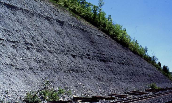
Looking ~SSE.
Radioactive material has
contaminated part of the land around the DOE's Mound Facility at
Miamisburg. Portions of the contaminated areas have been “cleaned up” and
are now a city park (just west of this railroad cut). Radioactive cleanup
of the Mound Facility itself (top of hill in photo) continues to the present
day.
OHIO BRUSH CREEK AREA
Excellent
Ordovician-Silurian boundary sections occur in the vicinity of Ohio Brush
Creek, Adams County, southern Ohio. The O-S boundary itself is not
conformable here. As most localities on Earth, the O-S boundary at Ohio
Brush Creek is a disconformity.
The uppermost-preserved
Ordovician in Adams County, Ohio is the Preachersville Member of the Drakes
Formation. At Ohio Brush Creek, this is mostly reddish and greenish
clayshales. The reddish shales represent distal lithofacies of the
Queenston Delta, a large pile of sediments shed westward from the ancient
Taconic Mountains. In eastern Ohio, the top-Ordovician is a thick,
subsurface, red shale formation called the Queenston Shale.
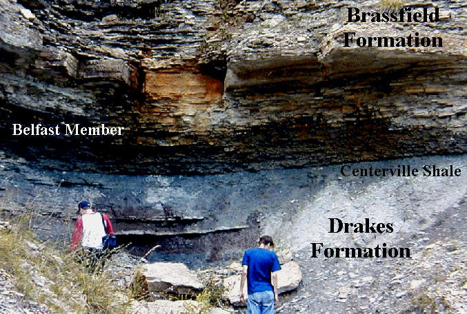
The top contact of the
Drakes Formation is an unconformity. It is overlain by a thin greenish
shale unit called the Centerville Shale. The Centerville is the
basalmost preserved Silurian unit in the area. The Centerville is capped
by an obvious planar unconformity. Overlying the Centerville Shale is the
Brassfield Formation, a mostly fossiliferous limestone unit (at least in
Adams County, Ohio. The basal portions of the Brassfield Formation is a
unit called the Belfast Member. The
Drakes-Centerville-Belfast-Brassfield succession can be seen at several
roadcuts in the Ohio Brush Creek area.
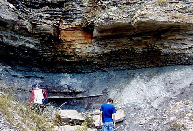
The pics above & below
show the Ordovician-Silurian boundary succession at a roadcut along Rt. 41,
just south of the Lick Run Road intersection, between West Union and
Dunkinsville (central Adams County). The stratigraphy at the Lick Run
roadcut is beautifully exposed. Good fossils weathering from the
Brassfield Fm. cliff above can be found along the shale slopes near the base of
the cut.